Urban Analytics
Digital metrics in the physical world.
Detailed measurement and analysis on pedestrian and vehicle flows in urban environments.
Smart City
AI solutions to improve citizen services
Monitors and analyzes mobility data to create connected and smart territories.
What are the benefits of this solution?
- Efficiency of municipalities’ costs related to public services
- Improving the quality of life of citizens by optimising the public services offered
- Create new public services for citizens
What can we support municipalities or companies in?
We operate in various verticals from mobility to public transport and waste management.
MOBILITY AGENCY
Data and technology
Timely Insights to enhance territorial services
DATA AND TECHNOLOGY
Monitor vehicle and pedestrian flows of the main arteries, access points to the city’s nerve centers, public parking lots, and bicycle lanes.

# Pedestrians
% Gender
% Age
O/D Matrix
# Vehicles
Type of vehicles
Dangerous situations
Flow directionality
Data Visualization
Custom data platform to visualize and export data
Anonymous and aggregated data collected in real time can be accessed on Blimp Analytics dashboards or transferred to third-party platforms.
DATA VISUALIZATION
With Dashboard Blimp Analytics for:
- Benchmark – comparator for the different tourist areas monitored
- Analysis and comparison of the focal points of the city/event areas
- KPI analysis to make strategic decisions on mobility in the area
- Integration via API
- Export to excel
Commercial packages
Choose the best package for you
Select the depth of analysis according to the needs of your municipality and get timely insights.
STARTER
Real-time analysis and counting of transits in a specific area
PRO
Flow analysis and detailed vehicular and pedestrian classification
Includes data from the STARTER package
ADVANCED
Nationality and Security Analysis
Include i dati dei pacchetti STARTER e PRO
STARTER
Real-time analysis and counting of transits in a specific area
PRO
Flow analysis and detailed vehicular and pedestrian classification
Includes data from the STARTER package
ADVANCED
Nationality and Security Analysis
Includes data from the PRO package
Prohibited Uses
Speeding, prohibited parking, motorbikes on pavements
Security
Jaywalking, pedestrian/vehicle interaction counting, detection of abnormal gatherings or situations
Want to know more about commercial packages?
Do you want a quotation?
Case Studies
Explore application cases
Examples of projects fielded with our clients.

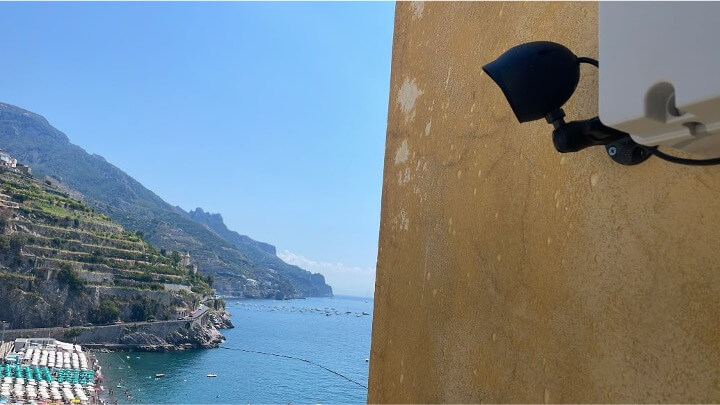
The request was to activate Blimp’s data service to collect real-time information on vehicular and pedestrian flows at key mobility points in the Amalfi District.
The data analysed enabled the following questions to be answered:
- How many vehicles pass along the Amalfi coast every day and every hour?
- In which direction do the vehicles move depending on the day of the week and the time of day?
- Are they coming from Vietri or Positano?
- What type of vehicle is most present along the coastline?
- What are the busiest stretches of road on the coast?
- How many pedestrians cross the main road on the Minori seafront?


On the occasion of the 2019 edition of Mille Miglia (15-19 May), Blimp sensors were installed on the vehicles to: measure the number of spectators along the entire route of the event and subdivided by stages; socio-demographic classification of spectators (age, gender, groups); define the volume of brand exposure for each stage of the route; monitoring through the acquisition system installed on board 4 cars distributed within the convoy.
Verified accuracy rate: 98.3%.


Fondazione LINKS, as part of the TEXTOUR project, has just launched a technological experimentation project to monitor vehicular and pedestrian flows in the Crespi d’Adda area.
The objective is to know the flows in access to the tourist area, in order to collect data for determining specific actions in the area and their results.
In particular, head counter sensors were installed for:
- Vehicular access: analysis of vehicular inflow at regular time intervals (Corso Manzoni);
- Pedestrian, cycle and point-of-interest access: analysis of regular time and pedestrian flows at points of interest (Corso Manzoni, Cemetery Area and Via Privata Crespi)
- Status of car park occupancy: Turnout and occupancy of a car park (Via Privata Crespi)


The Riviera del Brenta is an area between the provinces of Padua and Venice on the banks of the river Brenta.
In this context, the the Conference of Mayors of the Riviera del Brentawas established, which groups together the municipalities of Campagna Lupia, Campolongo Maggiore, Camponogara, Dolo, Fiesso d’Artico, Fossò, Mira, Noventa Padovana, Pianiga, Stra and Vigonovo.
The need was to set up a mobility agency pilot project to monitor vehicle traffic throughout the area in order to collect data that would enable the planning and implementation of specific actions in the area. The specific focus was on vehicle mobility with detection of HGVs and analysis of the 'dangerousness' of road sections by correlating the data of HGVs with that of other vehicles (e.g. ratio of no. trucks/no. bicycles).


